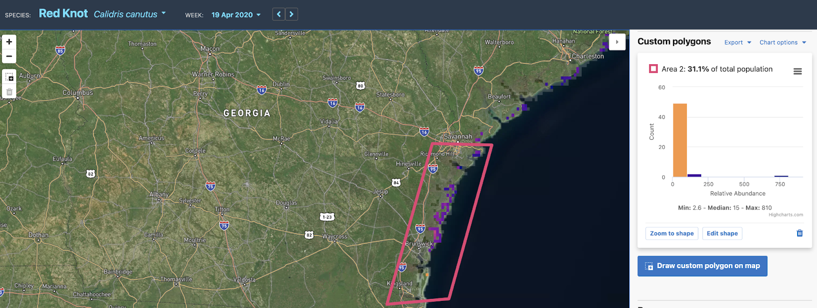


For decades, researchers have relied on citizen science (see Manomet’s International Shorebird Survey) to get a complete picture of how many shorebirds use certain areas across their geographic range. Understanding where shorebirds go throughout their annual cycles gives scientists clear insight on where to direct management action, as well as additional environmental threats that may affect shorebird abundance. In September 2021, the Cornell Lab of Ornithology released ShorebirdViz: a new tool that will revolutionize our access to information on shorebird abundance across flyways in the Western Hemisphere.
Citizen scientists have been entering bird sightings into Cornell’s eBird since 2002. Yet, for the most part, according to Tom Auer, geospatial data science team lead at the Cornell Lab of Ornithology, the data products have been “locked up in data formats that require technical skills to use.” With ShorebirdViz, eBird “combines observations of shorebirds in eBird with state-of-the-art statistical models and machine learning” to produce maps and graphs that present these data through easy-to-understand visuals. These data span the entire Western Hemisphere and show population trends and relative abundance of every shorebird species found in this part of the world by location and time of year.
“By listening to and working with our partners, including Point Blue Conservation Science, Manomet, and Calidris, the Cornell Lab of Ornithology was able to build an interactive tool that contains a level of detail never even imagined five years ago,” says Chris Wood, managing director of the Center for Avian Population Studies at the Cornell Lab. “ShorebirdViz is a major accomplishment that will drive the future direction of the Lab and advance conservation globally.”