


About the data
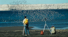
Manomet created this map using ISS records retrieved from eBird, an online database of bird distribution and abundance from the Cornell Lab of Ornithology. The International Shorebird Survey (ISS) is an organization of dedicated volunteers conducting field surveys during spring and fall migrations to provide hemispheric data on shorebirds. To learn more about ISS, go to https://www.manomet.org/program/shorebird-recovery/international-shorebird-survey-iss
If you are interested in becoming an ISS volunteer, contact Lisa Schibley at [email protected].
How to use this map tool
On the right, a number of controls and filters helps you select which shorebird records you will see mapped. With the default settings, simply clicking on “Show Map” near the bottom will return all ISS records in the database for the last 10 years to the map. You can then zoom into any particular area you wish. Alternatively, use the drop down menus to select for species, location, date, or other filters to limit the size of your data.
Select Species
Only shorebirds are shown on this map. In the drop down list, shorebirds are listed alphabetically by common name. A user can select all shorebirds or a single species.
Select Project
By including other projects on the ISS mapping tool, we hope to present a more complete picture of shorebird status and distribution in the western hemisphere. We have added the Caribbean Waterbird Census (CWC) in the Caribbean and the Coastal Shorebird Survey (CSS) for much of South America. The CWC is a multi-partner region-wide waterbird and wetland monitoring program led by BirdsCaribbean. Each year, BirdsCaribbean organizes one region-wide count during a 3-week period from January 14th to February 3rd, providing a “snapshot” of waterbird population numbers and habitat use. Counts are also encouraged as often as possible throughout the year, especially during migration periods. The CSS is a multi-national monitoring program for non-breeding waterbirds in South America with a goal to identify important shorebird sites and monitor the shorebird populations as guided by national NGOs.
You can present any combination of ISS, CWC, and CSS data by selecting the appropriate checkbox(es).
Select Location (select Site after Country and State)
A single country, a single country and state, or a single ISS location can be mapped. The locations available in the drop-down list are only ISS or CWC locations, not all locations in eBird.
Select Month(s) and Year
*Database currently includes all shorebird records entered into eBird through December 2018*
Select the month(s) you would like to include.
Select the year(s) you would like to include. The default is to map data from the last ten years, but you can choose any range of years to map.
“Show Map” and “Reset”
“Show Map” renders the map with the current set parameters. “Reset” changes the parameters back to their original settings (All species, Only ISS data, All locations, All Months, Past 10 years)
“Download”
This download button creates a .csv file that holds all the data that is within the parameters selected on the user interface. Please note, this is independent of what is rendered on the map. The downloaded data does not only include locations that are shown on the map. It includes all data that has been selected in the right control panel, regardless of where the map is zoomed into. If you wish to download data from just one location, make sure that location is selected on the drop-down list. The Download button is not available until a set of data has by chosen through the selection buttons.
Polygon Download Tool
After a selection of data has been sent to the map using the “show map” button, a set of tools appears at the top of the map. A hand is the default “pick” tool. This tool enables a user to select an icon and drill down into the data of that particular site. The Polygon Download tool enables the user to select a group of ISS sites and download the data from all those sites in a single file. After selecting the tool, click (single click) at the start of your desired polygon to create your starting vertex. Then move the mouse to the next vertex and repeat the single click and repeat for as many vertexes as you wish. Finish the polygon by moving the mouse back over the original vertex and making a single click. At this point, if you hit the download button, a .csv file that holds all the data that is within the polygon will be downloaded to your computer.
This map is a work in progress with many improvements on the drawing board. If you are interested in offering suggestions or requests, please contact Lisa Schibley [email protected]