

Arne J. Lesterhuis
Senior Shorebird Conservation Specialist
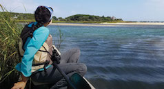
For three consecutive years, Manomet Conservation Sciences has been conducting shorebird surveys on Bonaire and Curaçao to enhance our understanding of the habitats these tropical islands provide during southbound migration. Many species of shorebirds along the Atlantic Flyway move through the Caribbean on their way to northern South America, or even further, and often use these islands to refuel and rest. Even more so, tracking studies showed that these islands function as a safe haven when heavy tropical storms and tornadoes make it highly risky or even impossible to continue their journey.
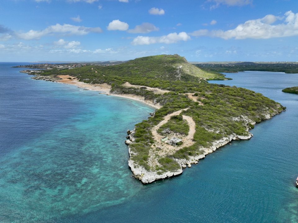
Implementing these surveys is crucial, as many shorebird species along the Atlantic coast – including the Semipalmated Sandpiper and Lesser Yellowlegs – have lost more than 50% of their population in recent decades. For these reasons, understanding what sites and habitats are key to these long-distance travelers is especially important, particularly given that Bonaire and Curaçao are tourist hotspots, making development an ongoing threat to the limited available natural habitats.
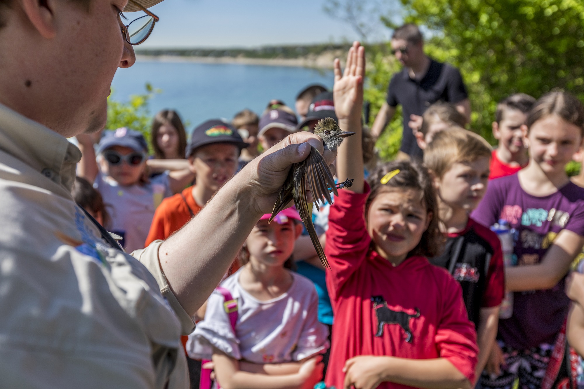
The monitoring program started in 2023 in collaboration with WILDCONSCIENCE from Bonaire. Volunteers have been trained in shorebird identification and the International Shorebird Survey (ISS) protocol. Since the program’s inception, several key sites for shorebirds have been identified on Bonaire and Curaçao. While numbers on any given day do not appear high or noteworthy, it is the total numbers across the migration season that demonstrate the islands’ importance.
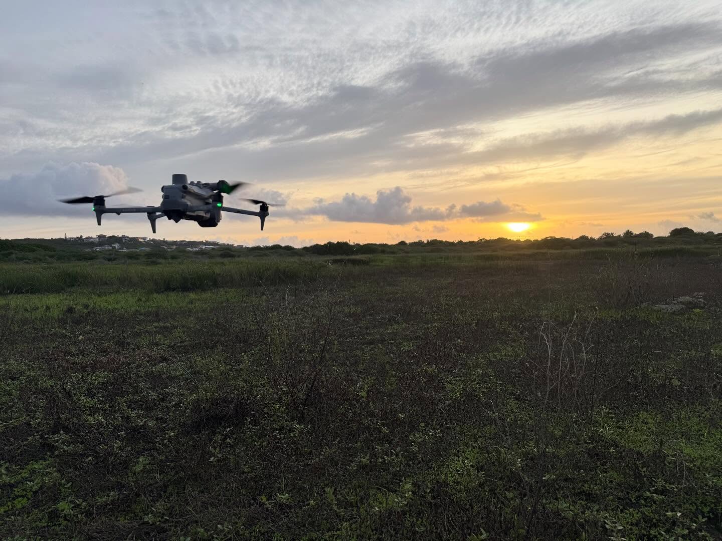
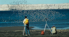
In 2025, Manomet and WILDCONSCIENCE continued the periodic shorebird surveys along the coasts of Bonaire and Curaçao in those areas identified as most important based on abundance. However, this time, in addition to the regular ground surveys, we conducted a pilot study on Curaçao using high-performance drones to identify shorebird roosting sites within mangroves and other habitats where access or visibility is challenging. Expanding the ability to identify all areas critical for roosting shorebirds in areas with limited habitat availability provides an opportunity to develop targeted conservation measures to ensure the protection of the shorebird populations during migration.
The positive developments in drone use for conservation offer several exciting opportunities. One of these is the use of high-tech thermal drones to monitor shorebirds in habitats that are difficult to access, such as mangroves, salt marshes, and coastal swamps. Piloting this technology during southbound migration on Curaçao provided valuable insights for future studies using this methodology to identify key shorebird sites. To implement the drone surveys, we partnered with a professional drone pilot from the Netherlands, Simon Spriensma from Aviadrone, who has nearly a decade of experience flying drones for shorebird habitat mapping and nest finding for conservation purposes. He is skilled in operating a wide range of drones, including both mapping and thermal systems.
One of the key findings from using thermal drones on Curaçao is that, despite the warm tropical conditions, thermal imaging performs exceptionally well. Birds and mammals stand out clearly on the high-tech display of the drone controller, especially in the early morning, after nighttime cooling of the environment, Even the smallest shorebirds, such as the Least Sandpiper and the Semipalmated Plover, were readily detected, as well as migratory songbirds like the Bobolink, which also appeared clearly in the thermal imagery.
By flying at altitudes of approximately 50 meters and angling the gimbal (the camera housing) at 30–35 degrees, disturbance was minimal to non-existent. Most birds we detected continued foraging undisturbed. The combination of using the latest low-noise propellers and the attached spotlight enabled us to conduct nighttime surveys (with the appropriate permits). Thermal imaging was used to locate birds, after which the adjustable-intensity spotlight allowed for species identification. This monitoring approach makes it possible to accurately map which bird species are present, where they occur, and in what numbers in difficult-to-access habitats—all without disturbing the birds.
>Cryptic shorebird species such as the migratory Wilson’s Snipe, were compared with regular visual counts and, in some cases, were recorded in numbers up to 15 times higher. In addition to these species, other shorebirds and a wide range of other bird species could also be mapped in detail. All habitats where birds were detected were mapped by creating a 2D orthographic map during daytime. This involves capturing hundreds of aerial photographs with a drone and stitching them together using specialized software. This detailed photographic record serves as an accurate “zero measurement” for future environmental monitoring and conservation.
The use of high-tech drones has demonstrated significant potential. The Curaçao pilot project proved the value of drone technology in the field. The team is now planning to move toward systematic monitoring, using standardized methods to collect reliable shorebird data across key habitats on Bonaire, Curaçao, and potentially beyond.
If you’d like to learn more, watch The Small Sit Webinar conducted by Arne Lesterhuis and Simon Spriensma from Aviadrone here.
The migration surveys in both Bonaire and Curaçao were supported by Dinamo Fonds