


This article was originally published on keepMEcurrent.com on September 4, 2013. It was written by Duke Harrington. View the original article here.
SCARBOROUGH, MAINE – Steve Stracqualursi doesn’t need a government-funded study to tell him things are changing in the waters around Scarborough.
“I catch more crabs than fish now. They grab right on to the line,” he said last week at a Town Hall forum held to discuss the impacts of sea level rise.
Stracqualursi, one of about 60 residents to attend the session, was referring to the growing numbers of European green crab, which can take over native clam flats. But this summer also has seen an explosion in Asian shore crab, which burrow into sandy areas, killing marsh grasses at the roots.
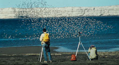
According to Peter Slovinsky, a marine geologist with the Maine Geological Survey, warming ocean waters, a global phenomenon which also accounts for rising sea levels, fuels the crab infestation. For local residents, the Aug. 28 meeting was a chance to hear an account of Slovinsky’s work during the past six months to gauge how sea levels, which are predicted to rise up to 6 and a half feet by 2100, will impact Scarborough Marsh and other low-lying areas of town.
“This isn’t a Chicken Little scenario,” said Assistant Town Planner Jay Chace. “We’re not saying this is something we need to jump on immediately, but it is good to start thinking about these issues.”
In an effort to begin that thought process, Scarborough applied last winter to join the state’s “marsh migration” project. Six towns were selected by the Maine Municipal Planning Assistance Program and are now using Slovinsky’s data to look down the road and take the first steps toward preparing for the impacts of rising sea levels.
“You can take a town to water, but you can’t make it plan,” joked Liz Hertz, who is managing the project for the Maine Department of Agriculture, Conservation and Forestry, “but it’s less expensive and less traumatic if you can plan ahead, instead of reacting to an emergency.”
According to Chace, the state data, along with input from community members at last week’s meeting and other meetings to come, may eventually end up at the town’s long-range planning committee, driving any number of changes to local zoning ordinances.
The idea, said Chace, is to develop policy by first figuring out what in town is most vulnerable to ecological change. Toward that end, he said, the Town Hall forum was meant to test the waters, so to speak.
“This is really the beginning of our steps to gauge community interest in this initiative, to see if this is something the town should be working on,” he said.
Although most residents who turned out to last week’s meeting probably won’t be around to use a sail-through window at Anjon’s in the 22nd century, there was keen interest in how Scarborough will adapt in both the short- and long-term.
“Before the sea level hits our homes, it’s going to hit our pocketbooks,” said one woman in the audience.
Steve Walker, of the Maine Coast Heritage Trust, concurred. The Manomet Center For Conservation in Plymouth, Mass., has estimated that marsh activities, including fishing, birding and hiking, bring $1,400 per acre into the local economy each year, he said. If true, that’s almost $4.5 million Scarborough stands to lose as climate change alters what is, at 3,252 acres, Maine’s largest saltwater marsh.
According to the Northeast Fisheries Science Center of the National Oceanic and Atmospheric Administration, water temperatures in what it describes as the Northeast Shelf Large Marine Ecosystem hit a 150-year high in 2012.
Slovinsky, who also chairs Scarborough’s Conservation Commission, pointed out in his presentation to residents that thermal expansion – a phenomenon in which warm water takes up more physical space than cold water – accounts for a large part of rising sea levels. Data from local observations in South Portland show the shoreline has been creeping inland at about 1.8 millimeters per year since 1912 – that’s 7.5 inches total over the past century. What concerns scientists like Slovinsky is that sea levels grew faster from 1912 to 2012, based on radiocarbon dating of mean tides in Wells, than at any point in the last 5,000 years, when modern beaches formed after coastal areas finished rebounding from the weight of retreating glaciers at the end of the last ice age.
According to an International Panel on Climate Change report issued in 2001, sea levels are expected to increase 1.6 feet by 2100, based on thermal expansion alone. Add in the impact of melting ice sheets at the earth’s poles and that inundation could rise to as high as 6 and a half feet.
Today, Slovinsky said, the rise in sea levels locally is trending upward 60 percent faster than in the 2001 study.
Earlier this year, Slovinsky got a $200,000 grant from NOAA, obtained by the Maine Coastal Project and its various partners, to map out the impact on the marsh of sea level spikes on the order of 1, 2 and 6 feet, as well as 1 meter (3.3 feet).
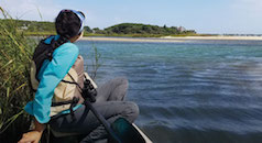
During the summer, Slovinsky and his team canvassed the marsh with GPS systems in order to “ground-truth” local elevation levels measured in flyovers of planes using light detection and ranging (LiDAR) data equipment.
Using those measurements, Slovinsky was able to predict where the waterline in Scarborough might be in the future. Although he stressed his study was based solely on a straight horizontal rise, or “bathtub method,” without accounting for erosion and other environmental factors, there is good news. To a large degree, it is not until sea level rise approaches the 6-foot mark that much of Scarborough Marsh converts to open water. The bad news is the ecological change expected to occur with a sea-level rise of 2 feet.
Most government agencies and other scientific study groups agree that sea levels will rise 1 foot by 2050. “Beyond that,” he said, “there’s less agreement.” However, a 2-foot rise by 2100 is the level accepted by the Saco Bay Sea Level Adaptation Working Group, a joint effort formed in 2010 by Scarborough, Biddeford, Old Orchard Beach and Saco, as well as the Maine Geological Survey.
In the 2-foot rise scenario, Scarborough’s coastal wetland area could increase by 18.8 percent. The bigger news, however, is that about 2,000 acres of marshland would convert from to “low marsh” habitats, marking a major fight for survival to both flora and fauna.
The elevation difference between these two distinct zones – high marsh and low marsh – is usually only a few centimeters, according to NOAA. But that can make a world of difference. A low marsh floods daily at high tide, while a high marsh usually floods about twice a month during tides that occur in conjunction with new and full moons.
More frequent flooding makes low areas the saltiest part of a salt marsh and mark a clear line of demarcation between life in the two areas. According to NOAA, plants from one marsh zone are never found in the other.
And while some may not shrug too much at the struggles of plants and wildlife, there is an impact even with a modest rise in sea levels, when coupled with the effect of powerful storms.
Slovinsky has previously predicted that adding 2 feet to the normal high tide would inundate 20 homes along Higgins Beach during a standard weather event. Adding 2 feet to the still-memorable 1978 storm, when a local 3.5-foot surge coincided with an astronomical high tide, would flood 95 homes.
If current projections become reality, Slovinsky said, even a modest 2-foot rise in sea levels could put four miles of Route 1, Black Point Road and Pine Point Road under as much as 4 feet of water during typical storm surges, while a mile of the Pan Am railway, used by the Amtrak Downeaster, would also face flooding problems.
According to Slovinsky, even a 1-foot rise in sea level, when added to the average storm surge, means that the impacts of a so-called 100-year storm – one that has a 1 percent chance of occurring in any given year – would be felt about every 10 years.
Chace said that Slovinsky’s report will be posted to the town’s website soon for study by residents unable to attend the forum.