


This article was originally published in The Biddeford-Saco-OOB Courier (Maine) on September 5, 2013. It was written by Ben Meiklejohn. View the original article here.
SCARBOROUGH, MAINE – About 50 people attended a public presentation sponsored by the Scarborough Conservation Commission Aug. 28 to learn about the possible impact of a global rise in sea level on the Scarborough Marsh. Marine geologist Pete Slovinsky of the Maine Department of Agriculture, Conservation and Forestry presented projection scenarios for rises in sea level from one to 6.5 feet over the next century.
Scarborough is also part of the Sea Level Adaptation Working Group, which has worked since 2009 on sea level and storm issues in Saco Bay communities, including Saco, Biddeford and Old Orchard Beach. The group “has completed a baywide vulnerability assessment … and is working to prioritize vulnerable critical public insfrastructure,” Slovinsky said.
Jay Chace, the town’s assistant planner, said in an introduction that the workshop was “not intended to be a Chicken Little-‘sky is falling’ presentation,” but rather, it was a starting point to plan for “issues that are quite a ways out.”
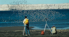
The National Oceanic and Atmospheric Agency Project of Special Merit funded the research. Scarborough is one of six communities in Maine receiving agency support to look specifically at marsh migration. The other municipalities are Topsham, Bath, Bowdoinham, Georgetown and Phippsburg. The U.S. Fish and Wildlife Service North Atlantic Landscape Conservation Cooperative also provided additional funding because of the importance of Maine’s saltwater marshes for migratory birds.
Slovinsky gave a PowerPoint presentation using topography data, sea level and storm surge data from the past 100 years, and trends in sea level changes in recent years. Slovinsky, who serves as chairman of the conservation commission, said there are two primary factors that contribute to rising sea levels – thermal expansion, when the ocean expands due to rising temperatures; and volumetric increase, when glacial melting increases ocean water volume.
Slovinsky said rises in sea level have accelerated during the last 20 years and are trending 60 percent faster than 2001 predictions. Data on storm surges – storm-generated rises in water levels above and beyond astronomical tides – from 1912 to 2012 was looked at as an indicator of the impact that rising sea levels may have on future storm surges.
A 100-year storm is a term that defines a storm’s intensity level according to its average frequency of 1 percent chance occurring each year. Slovinsky said, according to the study, a 100-year storm only has a one-foot additional increase in water levels from a 10-year storm.
“What this means,” Slovinsky said, “is that with a one-foot rise in sea level, storms we see every hundred years, we could be seeing every 10 years.”
By 2100, Slovinsky said data shows that sea levels could be expected to rise at least eight inches, and possibly as much as 6.6 feet, “probably rising one foot by 2050.”
To determine sea level impact on the marsh, scientists had to get accurate measurements of the topographical elevation levels of the area, using both radar sensing and ground truthing techniques. Emitting radio signals from planes overhead and waiting for the signals to return provides the necessary radar data. Ground truthing is a method on the ground by which geographers can determine the accuracy of the radar data. The average mean of difference between the two sets of data was 2.2 inches, Slovinsky said.
During the presentation, Slovinsky used maps to illustrate the potential impact on Scarborough Marsh of varying increases in sea level. The marsh is comprised of 25 percent low marsh, which is flooded by tidal water for a great portion of the day, and 75 percent high marsh, which is located above the mean highwater mark and is only inundated with water during exceptionally high tides or storm surges. As sea levels rise, Slovinsky’s maps demonstrated a reversal of the marsh proportion, so that eventually, there could be a greater amount of low marsh than high marsh.
Much of the current marshland could eventually convert to open water, according to projections. At a 3.3-foot rise, nearly 13 percent of the marsh would be underwater. At a 6-foot rise, 95 percent of the marsh would be open water. The marsh habitat could migrate inland, and 80 percent or more of new land that it may inhabit is currently used for natural or agricultural purposes. The remaining 20 percent of land that the marsh could take over is currently developed.
Road and rail infrastructure could also begin to be impacted, Slovinsky said. A one-foot rise would put Route 1, the Eastern Trail, Pine Point Road, and Black Point Road at risk of storm surge inundation. The rail corridor owned by Pan Am Railways could also be impacted at a two-foot rise in sea level.
Steve Walker, the land protection project manager for Maine Coast Heritage Trust, said the marsh contributes both economically and ecologically to the community. Research by Manomet Center for Conservation Sciences, a nonprofit conservation organization, estimated that each acre of Scarborough’s marshland contributes about $1,400 to the local economy, Walker said.
The marsh is also an important nutrient exporter, Walker said, sustaining sea life that supports commercial marine industry. Habitat conversion could affect dozens of species with the greatest conservation need, he added, as well as invasive non-native species such as the green crab.
Slovinsky said the data presented is intended to help the community plan accordingly and “do good vulnerability assessment work.”
“The purpose is (to educate) the public about the process, in using data for management of the low-lying areas adjacent to the marshes,” Slovinsky said. “How do we manage properties that are already owned? We don’t want to expand on properties that are going to be wet in 30 years.”
The Scarborough Marsh is the largest contiguous saltwater marsh system in the state and covers more than 3,000 acres.
The presentation was followed by a question and answer discussion in which residents raised concerns and shared changes they have already seen.
Steve Stracqualursi, a Pleasant Hill Road resident, said, “As a fly-angler, I am catching more (green) crabs now than ever. I’m pulling out crab after crab after crab … it’s strange, over the last five or 10 years, I don’t remember seeing them as frequently or as many of them.”
According to the Maine Department of Marine Resources website, green crabs are an invasive species from Europe that were first spotted in Casco Bay in 1900. The crabs feed on blue mussels and soft-shell clams, threatening the state’s third- largest wild fishery.
“The crab population used to be kept in check by the winter water temperature, because they can’t live below 32 degrees (Fahrenheit), but in the last three years, the ocean hasn’t really got that cold,” Chace said.
One person asked, “What are warmer waterbodies going to do?”
Slovinsky said these are examples of changes that haven’t been factored in, which could further affect sea levels, such as changes to the Gulf Stream.
“As surrounding water temperature rises, what will happen next? If the Gulf Stream collapses – the water would just be sort of sloshing around – it could raise sea levels rather quickly,” Slovinsky said.
According to NASA, a change in the ocean’s salinity level caused by rising temperatures – introducing large volumes of fresh water into the ocean from melting ice sheets – could cause the Gulf Stream to slow or stop. Consequently, the average temperature in northeast America could drop by up to 18 degrees.
Slovinsky said some communities are starting to incorporate rising sea levels into their comprehensive plans. York, for example, recently finalized a comprehensive plan that automatically assumes there will be a onefoot rise in sea level by 2050.
The Conservation Commission’s next meeting will be at 7 p.m., Monday, Sept. 9, in the Scarborough Municipal Building.